Turn your airborne lidar data into actionable insights with Flash Point Classifier
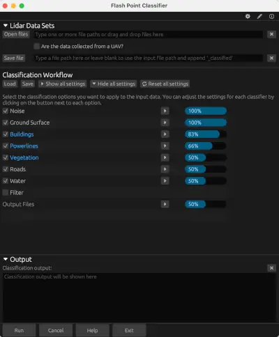
Flash Point Classifier is a powerful and user-friendly software tool designed to classify airborne lidar point clouds quickly and efficiently. Go from raw data to actionable insights in a flash!
Custom Classification
Customize the classification and tailor them to your unique data.
Manage Data Locally
Manage your own data resources. There's no need to upload your data to a 3rd party cloud service.
Cross-platform
Available for Microsoft Windows and macOS.
Multiple Languages
Lidar classification made easy
Try Flash Point Classifier today with our free trial or purchase a perpetual license now.
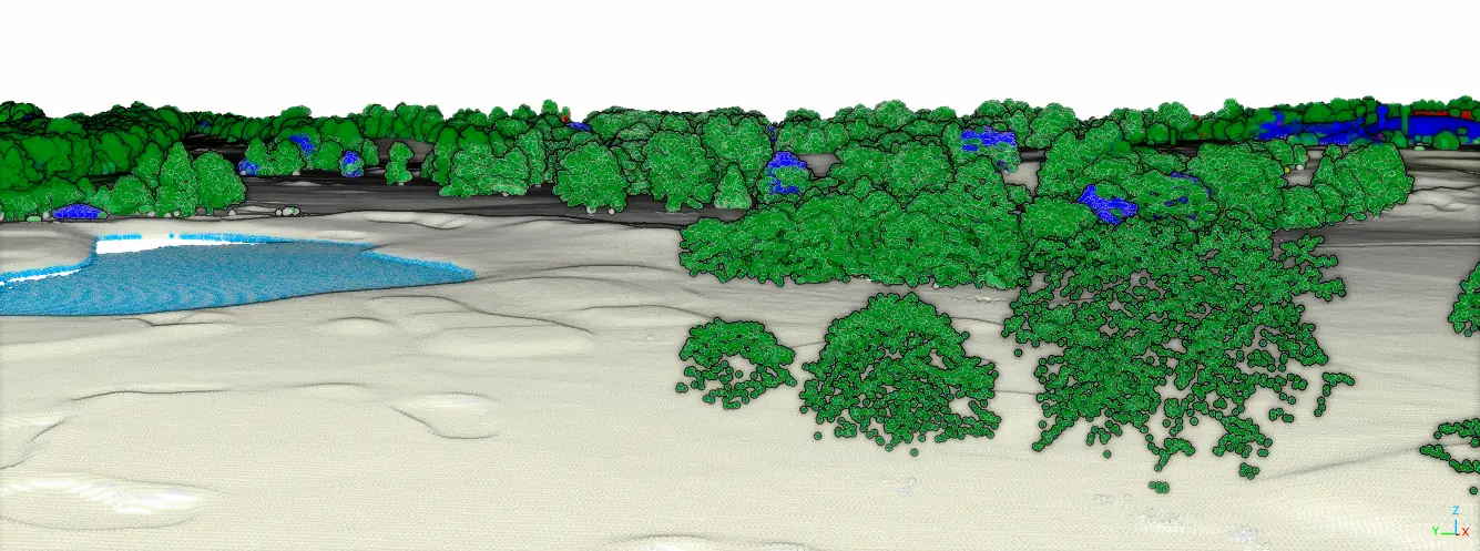
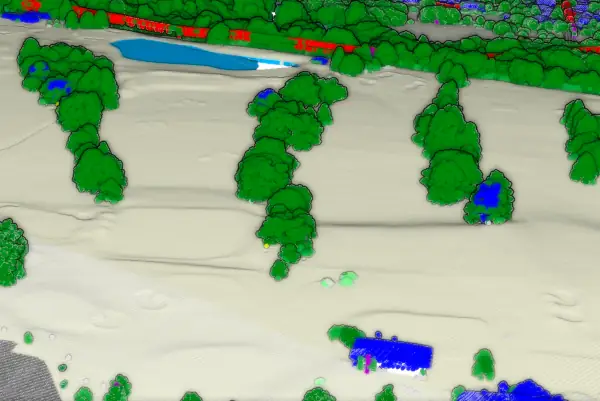
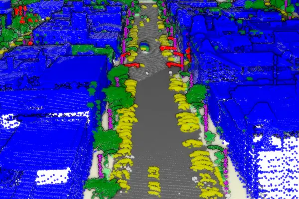
Classify your lidar point clouds into these categories
Click to close
Ground
Separate ground points in flat urban areas and steeper terrains
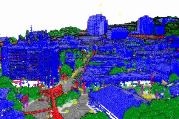
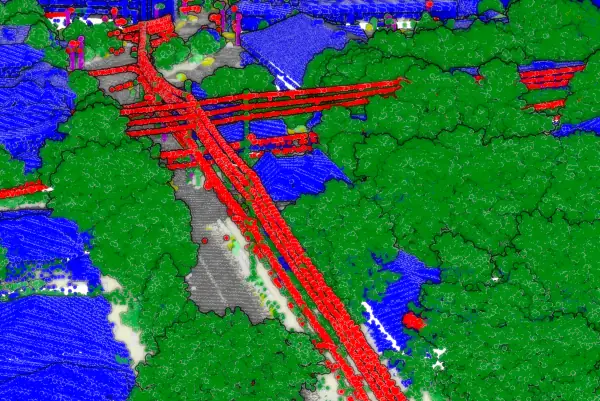
Buildings
Classify building roofs and facades
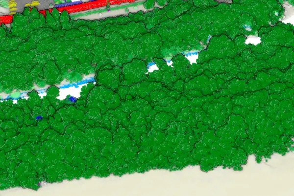
Vegetation
Classify low, medium, & high vegetation
Power Lines
Classify power lines
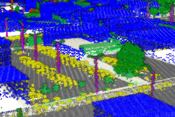
Poles
Classify poles and pole-like features
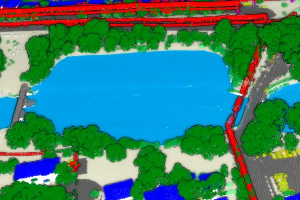
Water
Classify water bodies
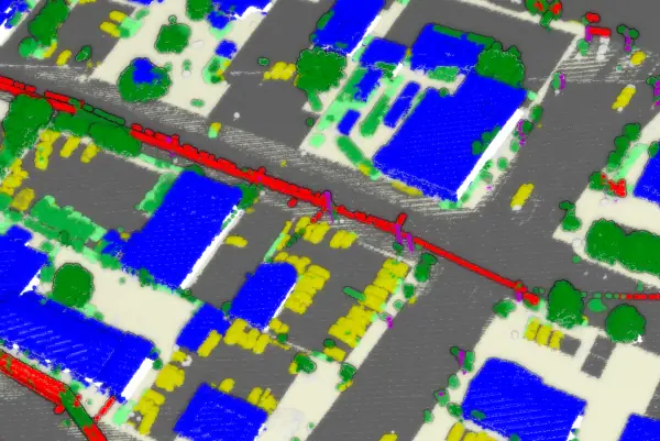
Paved Surfaces
Classify roads & parking lots
Vehicles
Classify cars and other vehicles
Noise
Classify and filter low & high noise points